Environment & Energy
Related: About this forumHigh Pressure System Crushing Arctic Ice; Regional Temps 4-20C Over Historic Averages
EDIT
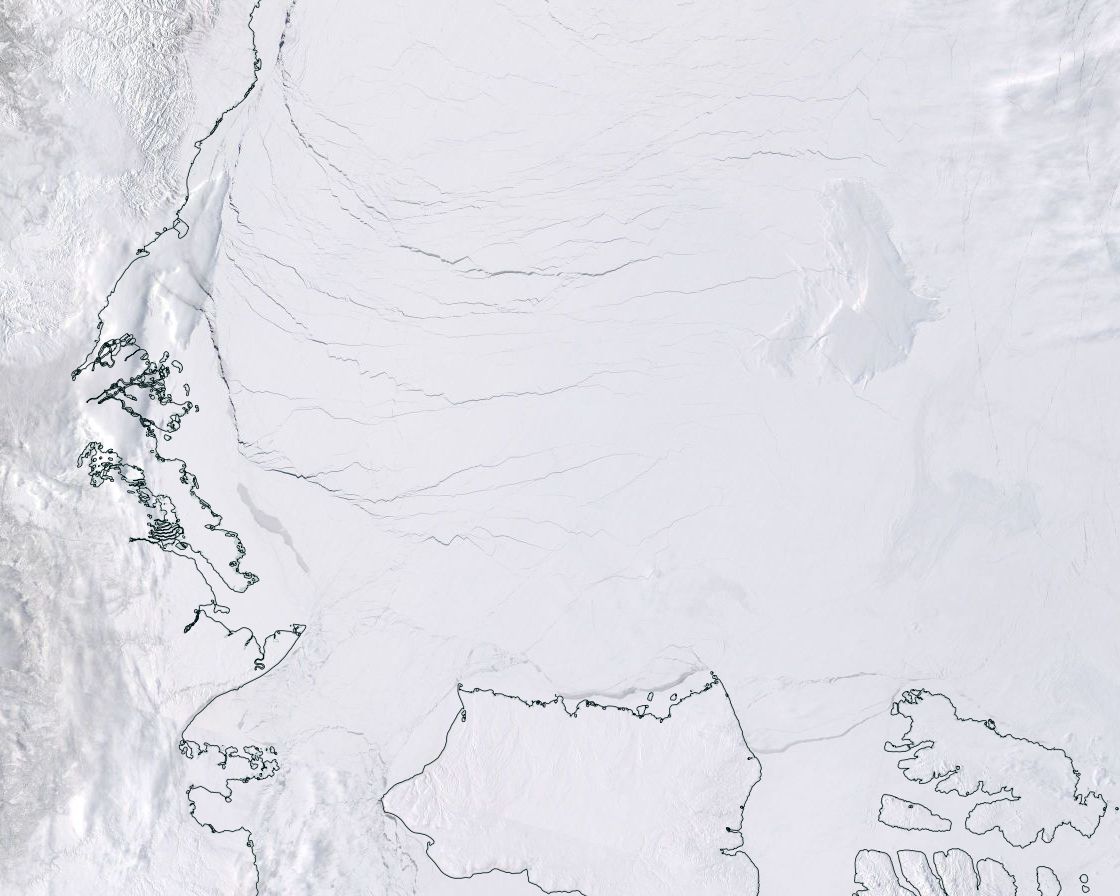
This powerful and strengthening system has already been in place for about two weeks — slowly gaining momentum as its circulation has moved in mirror to the waters of the Beaufort Gyre that swirl beneath it. Masked only by a veil of sea ice considerably thinned by human-forced climate change, the waters of the Beaufort are now breaking through. Streaks of dark blue on white in an early break-up enabled both by a terrible Arctic warming and by this powerful spring weather system.
 ?w=291&h=233
4/4/17
 ?w=291&h=233
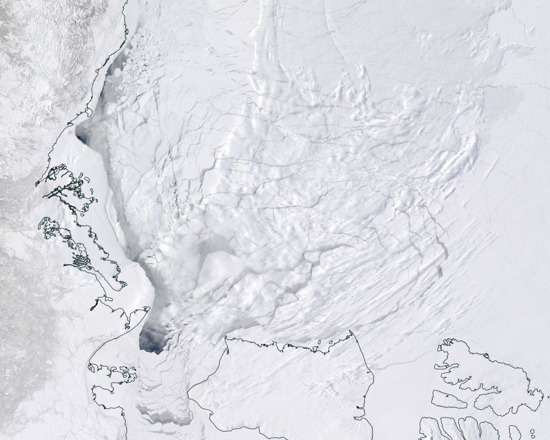
4/13/17
(Side-by-side (Ed. - in original page) images of Beaufort sea ice from April 4 [left frame] to April 13 [right frame]. Note the considerable and rapid advance of fracturing in a relatively short period. For reference, bottom edge of frame in both images is 500 miles. Image source: LANCE MODIS.)
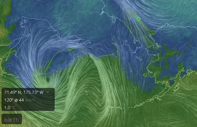
On the Siberian side of the Arctic, this massive high pressure dome is drawing in warm winds from the Pacific Ocean. Gust by gust and front by front, they come in the form of squalls that deliver above freezing temperatures and rains that blanket this thawing section of the Arctic. On Thursday, April 13, these warm winds had driven northward over 2,500 miles of Pacific waters to be drawn into storms that unleashed their fury — driving rains and gales through the already dispersed ice in the Bering Sea and shattering ice floes through the Chukchi. Today, April 14, these winds and rains drove northward to assault the ice of the East Siberian and Laptev seas.
 ?w=600&h=385
(On April 13, above freezing temperatures, rains, and gale force winds ripped through the sea ice near Wrangle Island in the Chukchi Sea. Image source: Earth Nullschool.)
In the past, meteorologists like Stu Ostro envisioned that climate change would tend to produce towering high pressure systems — featuring increasingly strong storms roaring about their fierce outer boundaries. And the massive high lurking over the Arctic at this time is a good example of Ostro’s predictions coming to light in a region that is very sensitive to human-forced warming.
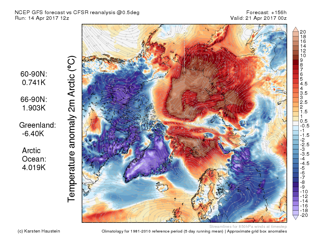
This great atmospheric stack appears to have had a considerable impact on the ice already — helping to push extent measures back into record low ranges by accelerating the melt trend. But these impacts are likely to spike over the coming week as this powerful high expected to remain in place through the next five days — continuing to draw warm air into the region.
 ?w=600&h=450
(Global Forecast System models predict extreme warming over the Arctic Ocean throughout the next week resulting from the influence of a powerful high pressure system and very strong associated ridge in the Jet Stream. Image source: NCEP Global Forecast System Reanalysis.)
EDIT
https://robertscribbler.com/2017/04/14/under-the-arctic-dome-brutish-high-pressure-system-is-wrecking-the-already-thinned-sea-ice/
 = new reply since forum marked as read
Highlight:
NoneDon't highlight anything
5 newestHighlight 5 most recent replies
= new reply since forum marked as read
Highlight:
NoneDon't highlight anything
5 newestHighlight 5 most recent replies

Achilleaze
(15,543 posts)...that this shit is not happening.
OnlinePoker
(5,721 posts)The area breaking up is shown as below average temperature by 3 to 5 degrees. The closest larger Canadian settlement is Inuvik and it is going to be 7c lower than average for a high today.

NickB79
(19,246 posts)The warm storm systems are hammering ice that's far outside it's heat "bubble".