Report: Groundwater pumping in California has land sinking
Source: Associated Press
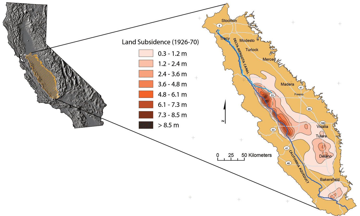
Vast areas of California's Central Valley are sinking faster than in the past as massive amounts of groundwater are pumped during the historic drought, NASA said in new research released Wednesday.
The research shows that in some places the ground is sinking nearly two inches each month, putting infrastructure on the surface at growing risk of damage.
... The report said land near the city of Corcoran sank 13 inches in eight months and part of the California Aqueduct sank eight inches in four months last year.
... A record low mountain snowpack has increased pumping of groundwater by farmers and other water users. Scientists used satellite images of the Earth taken over time to measure the sinking land.
Read more: http://www.sfgate.com/news/us/article/Report-Groundwater-pumping-in-California-has-6453467.php
 = new reply since forum marked as read
Highlight:
NoneDon't highlight anything
5 newestHighlight 5 most recent replies
= new reply since forum marked as read
Highlight:
NoneDon't highlight anything
5 newestHighlight 5 most recent replies

Dont call me Shirley
(10,998 posts)yeoman6987
(14,449 posts)Sorry but if built in a desert you should buy bottled water. Nobody should have built in a desert.
Dont call me Shirley
(10,998 posts)yeoman6987
(14,449 posts)Dont call me Shirley
(10,998 posts)We lost a lot of trees and landscaping because we did not water through the drought. Those that made it are stronger and more drought tolerant. NM is still moisture deficient, not having completely recovered.
So many forests burned, the air was thick with smoke for many summers.

CreekDog
(46,192 posts)i don't know why you are always wrong, but it's just uncanny.
reddread
(6,896 posts)CreekDog
(46,192 posts)That one is not a liberal.
4139
(1,893 posts)Really failing schools are us...

NeoGreen
(4,031 posts)...but I can't let this one go.
Nothing against Newsjock or the original post, since this is a really important issue, but if you had been paying attention this is not "breaking news":

And has been studied for quite some time in CA:
happyslug
(14,779 posts)If (and it is looking more and more like WHEN) the West Antarctic Ice Sheet (WAIS) collapses you will see within weeks, if not days, an increase in the Mean Sea Level of 20 feet, i.e. Stockton becomes a Sea Port. Now Modesto is another 60 feet higher in elevation. and thus will take a lot longer to become ocean front property, but that is if current elevations are maintained. If current elevations DROPS below 20 feet above mean sea level, then those areas would become water if the WAIS collapses.
Here is a Web Site with a map where you can adjust World Wide Sea Levels from Current to 60 meters (about 180 feet). The 20 feet/7 meter threat is something that can happen any March when the Ice Shelves around the West Antarctic Ice SHEET are at their smallest extend. The 60 meter is if the much larger East Antarctic Ice Sheet (EAIS) melts. Under current global warming theory, the EAIS will ground LARGER for a while, as the hotter air caused by global warming carries more moisture over the EAIS. At the same time the Smaller WAIS can break up any spring.
http://flood.firetree.net/
Side note: The above cite shows Death Valley as being under water, that is because the program is assuming anything below mean sea level will be cover by sea water. Sea Water has not way to get into Death Valley and thus will NOT flood. On the other hand, the Salton sea MAY flood if the WAIS collapses, for it is below mean sea level AND it is possible for sea water to reach the Salton sea if mean sea level rises 20 feet/7 meters. I use the term "May" for the route from the Gulf of Cortez raises just before that valley to over 7 meters in some parts. Thus it is possible no sea water will reach the Salton Sea, but sea water may reach the Salton Sea during high tides. It is only at 13 meters increase in sea level does the Salton Sea clearly become part of the Gulf of Cortez.
Please note, the West Antarctic Ice Sheet (WAIS) is the immediate danger, it is grounded BELOW sea level (thus its base is exposed to warming sea levels), the WAIS is located on both side of the Antarctic Peninsula which was a solid barrier till about 41 million years ago. When the Antarctic Peninsula broke from South America it permitted the advent of the Antarctic Current, that circles around Antarctic and isolates it from the west of the world. The problem is Drake's Passage is the bottle neck for that current, which means Antarctic Current MUST speed up to go through Drake's passage, this increase fiction and thus warms up the WAIS compared to the much larger EAIS (This need to speed up MAY be related to the formation of an El Nino, current research is weak on the subject). The Antarctic Peninsula is the only part of Antarctica that extends north of the Antarctic Circle, which means it is exposed to warmer temperatures then the rest of Antarctica. What this means is the WAIS is unstable and has been since the break up of the North American Ice Sheet 8500 years ago:
http://www.natureasia.com/en/research/highlight/1854
https://en.wikipedia.org/wiki/Lake_Agassiz
Now if the East Antarctic Ice Sheet (EAIS), when it melts will increase mean sea level another 60 meters of another 180 feet, making the whole central valley of California an huge inland sea. Fresno would still be while above sea level, but most of the rest of the Central Valley will be under water. Present theory says the EAIS will take centuries to melt, it is on land that is while above current and any future mean sea level. The EAIS is completely within the Antarctic Circle, thus it is a most secure ice spot on the earth. Current theory is the EAIS formed even before the Ice Ages started but after Drake's passage opened up 41 million years ago. Present theory hold the EAIS is at least 20 millions years old, with some people holding out for 35 million years of age (The WAIS is believed to be no older then 400,000 years, through it is also believed the WAIS has formed and melted away several times since the Ice Age Started 2.58 million years ago):
http://www.geos.ed.ac.uk/homes/des/antarctica_2.html
https://books.google.com/books?id=fRJtB2MNdJMC&pg=PA58&lpg=PA58&dq=age+of+%22east+antarctic+ice+sheet%22&source=bl&ots=dmfOZsiIOr&sig=S0ljdt3hDGW7ibadeoDBCgKQz7w&hl=en&sa=X&ved=0CC4Q6AEwAmoVChMI5-KS-sm2xwIVR_MeCh1VlAcp#v=onepage&q=age%20of%20%22east%20antarctic%20ice%20sheet%22&f=false
The Current Ice Age, Pleistocene glaciation, started about 2.58 million years ago.
https://en.wikipedia.org/wiki/Quaternary_glaciation
Side note: While the ice in the West Antarctic Ice sheet, when it melts, will increase world sea level 7 meters (20 feet) it can also cause rapid melting of other ice, increasing world wide sea levels by more then 7 meters relatively quickly (in one case 50 extra feet in a 350 year period):
http://phys.org/news/2014-05-antarctic-ice-sheet-unstable-age.html

http://blogs.ei.columbia.edu/2015/06/30/antarcticas-retreating-ice/
http://www.antarcticglaciers.org/antarctica/east-antarctic-ice-sheet/
East Antarctic Ice Sheet has Ice Sheets just under three miles deep:
https://en.wikipedia.org/wiki/East_Antarctic_Ice_Sheet
Just a comment, that this drop in elevation MAY come back to haunt the people of California if the WAIS collapses.

KansDem
(28,498 posts)People “should not be forced to live on property with brown lawns, golf on brown courses or apologize for wanting their gardens to be beautiful,” Yuhas fumed recently on social media. “We pay significant property taxes based on where we live,” he added in an interview. “And, no, we’re not all equal when it comes to water.”
Yuhas lives in the ultra-wealthy enclave of Rancho Santa Fe, a bucolic Southern California hamlet of ranches, gated communities and country clubs that guzzles five times more water per capita than the statewide average. In April, after Gov. Jerry Brown (D) called for a 25 percent reduction in water use, consumption in Rancho Santa Fe went up by 9 percent.
WP
heaven05
(18,124 posts)in any respect when it comes to the uber rich and greedy american upper class. Never have been, can't tell some people that though, they just won't believe, because they think they will be living raunchyosantefe one day...
LiberalElite
(14,691 posts)"Nothing will change in this country until people stop identifying with the rich."
reddread
(6,896 posts)ever.

potone
(1,701 posts)Freelancer
(2,107 posts)Has anybody out there ever tried drilling for water under the ocean a couple of miles out on the continental shelf? A lot of that was dry ground during the Ice age when the huge aquifers formed. There could be branches of aquifer that haven't been tapped out there.
The oil drillers on dericks out there might know if it's common go through water on the way down to find oil.
happyslug
(14,779 posts)First you must look at the continental shelf. Traditionally the continental shelf was seen as an extension of the Continent that was covered by water. The true deep sea only occurred once you went beyond the shelf. Unlike the East Coast and the Coast along the Gulf of Mexico, the West Coast raises quickly from the ocean. You also have a very Short continental shelf before you get to the HUGE drop off as you enter the deep sea. .
Here is a cite on Surfing and why the short Continental Shelf on the West Coast produces larger waves then the Contineal Shelf on the East Coast:
http://science.howstuffworks.com/environmental/earth/oceanography/question623.htm

https://en.wikipedia.org/wiki/Continental_shelf
Please be careful the US has extended its "borders" to the "Continental Shelf" as that term is used under the International treaty, which is 200 miles in extent. That is a definition for what is LEGALLY part of the US under International law, it should not be confused with the geographical term "Continental Shelf" which is the area between the coast and the sharp drop off to the deep ocean. The US legal "Continental Shelf" is 200 miles off all coasts, even where the actual "Continental Shelf" is much shorter, as on the West Coast, and much longer, as in the Gulf of Mexico and the Atlantic Ocean (The actual treaty says to the actual "Continental Shelf" but no less then 200 miles from a country's "baseline" which can be its coast or an island off its coast. One exception to this rule, when two countries Legal "Continental Shelf" overlap, then the border is the half way point between both countries (The US recognition of Cuba is related to finding oil on the shelf between Cuba and the US and the need to define who gets what oil out of that space more then any other single reason).
https://en.wikipedia.org/wiki/Continental_shelf
Thus the short Continental shelf off the coast of California is the first restriction on such underwater aquifers.
The Second problem is that California did not have any Ice Sheets on its coast during the Glacial maximums. The North American Glacier actually started in Newfoundland and spread north, west and south.
16,000 years ago California was a wet forest area, much like the American Mid West (Pittsburgh to St Louis) is today:
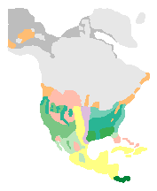
http://www.esd.ornl.gov/projects/qen/nercNORTHAMERICA.html
North America today:
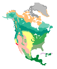
Thus no glaciers anywhere near the coasts of California during the last Ice Age. In fact the water California is using today MAY be water from a previous inter glacial period where the Pacific Ocean covered most of the Central Valley of California. Through the wet period California and the American South West went through during the last Glacial maximum provided most of the water being pumped out today.
Yes, during the last ice age, there appears to have been almost no ice or snow covering Alaska. Alaska was Polar Desert, cold with almost no snow. Thus the oil under the North Slope of Alaska remained oil for it never fell below 20,000 feet from the surface of the earth (when oil reaches depth of 20,000 feet, the heat of the earth converts it to natural gas, thus you get Natural Gas 100,000 feet deep but you do NOT get oil if the oil ever went below 20,000 feet).
Glacier ice in Antarctica can be almost three mile thick. It is possible that thicker ice sheets existed during the Ice Age. The weight of the ice would have force the ground down. Even today they are parts of the world that are still rebounding from the depth the ground went down do to the weight of the ice in the glaciers above that ground during the last ice age. 20,000 feet is about 4 miles, thus ice during the ice age MAY have been enough to force the Oil into Natural Gas if the oil ended up 20,000 feet or four miles from the surface of the ice.
While the Arctic Wildlife refuge in Alaska should have had no ice on it, the ice in Canada may have been enough pressure to force the oil in the refuge deep enough so it was converted to Natural Gas. Drilling will determine if that happened, but the geologists can NOT claim one way or the other based on the data they have today. This is one of the fears of geologists when it comes to the Arctic Wildlife Refuge, after all the fighting they had to do to get at that oil, they will be disappointed if it is Natural Gas instead but it is a possibly. The only question is how far did the ice sheet force the ground down, even ground where the ice sheet was NOT on, but near (and the above maps are estimates, the Ice Sheet MAY have reached the Refuge even if it missed the rest of Alaska).
Response to happyslug (Reply #15)
Freelancer This message was self-deleted by its author.
CreekDog
(46,192 posts)and there is groundwater in the communities near San Francisco, but it's an exhaustable amount and must be managed carefully.
happyslug
(14,779 posts)This thread started with a report that the Central Valley of California has lost elevation, which is true. On the other hand, the coast line has risen as it is push up as the North American Plate runs into and on to the Pacific Plate (The Juan de Fuca plate also exists in the area of contact, but is slowly disappearing as the North American Plate over rides it). In theory the Central valley should have risen over the last 100 years at the same rate as the coast and the Sierra Mountains, but the gain caused by the North American Plate over ridding the Pacific Plate is more then offset by drop caused by the withdraw of water in the Central Valley.

https://en.wikipedia.org/wiki/North_American_Plate
The Sierra Nevada Mountains are increasing in height about a 1 mm per year:
http://www.huffingtonpost.com/2012/05/04/sierra-nevada-mountains-age_n_1479272.html
http://pnsn.org/outreach/about-earthquakes/plate-tectonics
happyslug
(14,779 posts)As to water off the coast of California, I have NOT read of any such research or findings. Given Oil was found off the coast of California decades ago I suspect if there were any fresh water findings we would have reports of them.