Solving problems the old fashioned way (triangulation)
Today, plotting a fire, the old-fashioned way, deep in a drainage about five miles to my east-southeast. It was a lightning fire that I would never see, unless it got really big. Various fire crews called in azimuths from high points where they could glimpse the elusive smoke.
The fire was eventually located. But a big difference (31-degrees) in a shot taken 1/2 mile from where they actually located the fire - a shot down another drainage - has convinced me there is a second fire over there. A helo recon is ordered for tomorrow morning.
This is just about as much fun as you can have in a fire lookout. The team work is amazing. All of this is done on a tactical frequency, so officialdom is cut out until determinations are made. It was an intense day, but a different "intense" from yesterday's 1500+ strike lightning bust.
This plotting board reminds me of my aircraft cockpit in Vietnam. But that was then; this is now.
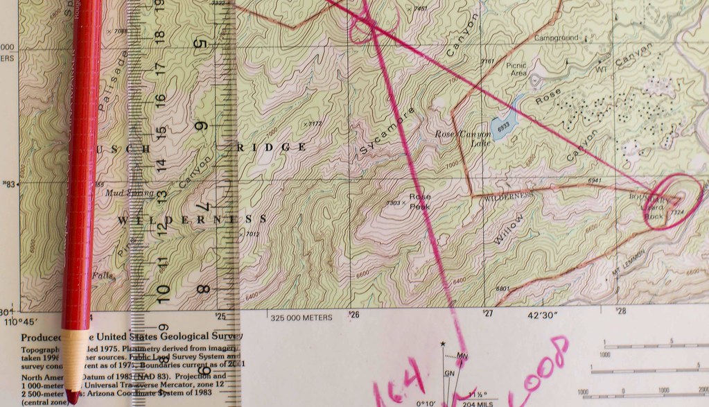
GPS vs. Map? HA! Try this with your GPS.
 = new reply since forum marked as read