General Discussion
Related: Editorials & Other Articles, Issue Forums, Alliance Forums, Region ForumsI need help missing the mountains. PLEASE HELP!
I'm in Bend, Oregon right now. I want to go to Colorado Springs, Colorado. Which city would I "aim" my GPS for, if I want to miss the mountains in Oregon?
Can someone help me with this?
 = new reply since forum marked as read
Highlight:
NoneDon't highlight anything
5 newestHighlight 5 most recent replies
= new reply since forum marked as read
Highlight:
NoneDon't highlight anything
5 newestHighlight 5 most recent replies

JanMichael
(24,890 posts)you can go South, and not hit the Cascades...I assume you are trying to miss Mt. Hood? etc?
Th1onein
(8,514 posts)WHICH city should I put into my GPS, to go South and avoid mountains?
JanMichael
(24,890 posts)when I lived out there, it was before GPS and cell phones. If you are going to be traveling during the day, I would almost head for Salt Lake City, or maybe Reno. Those roads are mostly two lanes, and the mountains aren't high, per se....
If you are leaving now, I would go North, and get on 26 and go over to Boise and then go from there. Four lane, well maintained highway. No awful mountain passes....easy drive. Good hotel right off the highway in Baker City.
Lydia Leftcoast
(48,217 posts)They still work. Try one some time.
By the way, if you're in Bend, you're east of the Cascades, which are the major mountains in the state.
But to get to Colorado Springs, you're going to have to go through mountains somewhere, if not in Oregon. The Rockies are in your way.
Th1onein
(8,514 posts)All the topographical maps don't have cities listed. All the maps that have cities listed don't show the mountains.
Try a little tolerance for people who might not be as bright as you so obviously seem to be.
Geez.
Lydia Leftcoast
(48,217 posts)By switching back and forth between "roads" and "topographical," you can see where both the roads and mountains are.
Th1onein
(8,514 posts)I think I need a little more precision than that. I get hopelessly lost.
Th1onein
(8,514 posts)Lydia Leftcoast
(48,217 posts)the Siskiyous.
Better to head east. I'd go across southern Idaho, down the valley toward Salt Lake City, but switching off into Wyoming at Logan, and then going south from Cheyenne, Wyoming along the eastern slope of the Rockies through Denver down to Colorado Springs.
But that seems like a lot of trouble just to avoid mountains.

mrs_p
(3,014 posts)you will need to connect to I80 via 139 to 395 (to Reno)

niyad
(113,329 posts)mrs_p
(3,014 posts)You need to go south to klamath falls and then down to nevada to hit I80 or you should get down the mountains towards the coast (Portland) and go around (up I5, then east along the Columbia through the Dalles towards Hermiston, then towards Boise, all the way to I80 again and down I25). No matter what you will hit some mountains, though.
Honestly, we drove east on 20 (from where you are) and was probably the best way to go even in the dead of winter.
Th1onein
(8,514 posts)Scared the hell out of me.
mrs_p
(3,014 posts)If time isn't an issue and you are very anxious about the drive, may be best to go west to Portland, then north to I84 and take all the way to I80. I80 to I25 down to the Springs. It is a long drive, but it is all highway. The only shady spot will be the mountains between eastern OR and western ID. Maybe you can make sure to do in the daylight. Also, there are lots of semis on all those roads, and can be lots of wind, so just drive cautiously and slowly.
Best of luck, and make sure to stop to keep yourself fresh.
We are headed to Yellowstone tomorrow, up I25 to I90.
Happy travels all around.

A HERETIC I AM
(24,370 posts)I've driven all over this country and been out where you are scores of times. If it was me, I would head East on US Rte 20 toward the Idaho line at Ontario, ID. Then catch Interstate 84 all the way down into Utah till it hits I 80.
80 across Wyoming to Cheyenne and South on 25 to Col Springs.
You are on the West side of the Rocky Mountains. You want to get to the East side. You are GOING TO GO UP.
You have no choice.
80 across Wyoming, while high in elevation, is nothing like I 70 across central Colorado. More rolling hills than steep mountain grades, really
mrs_p
(3,014 posts)

2naSalit
(86,646 posts)A couple ways to avoid some of the passes that might make you uncomfortable, because Parlay's outside of SLC and the Evanston canyon might not be fun for you and Sherman pass between Laramie and Cheyenne could be problematic for you too, and you may want to avoid the SLC mess altogether you could get on I-84 across Idaho like the others suggested and take it all the way to Pocatello (I-84 connects with I-86 at Raft River and terminates at I-15 in Pocatello) but all you do is keep going forward and don't turn off to SLC on I-84). So in Pocatello you go south (toward SLC) to McCammon on I-15 (for about 20 or so miles) then get on US30 east to Kemmerer, WY and on to I-80 outside Green River (actually Bigelow Rd by Little America). Take I-80 east to Laramie and get off on US287 south to Ft. Collins and then get on I-25 south to Colorado Springs. On US30 there are a few really SMALL mountains but nothing scary... and you could stop at Lava Hot Springs and relax for a spell. There are going to be hills if not mountains, be brave.
A lot depends on whether you prefer 2-lane roads with less actual mountain passes or if a mountain pass that doesn't have cliff views is your issue, or maybe it's the windy-curvy part that gets to you. Just remember to shift down when your vehicle isn't able to gain speed going uphill and go down the steep part in the same gear that you went over the top of the hill. And a speed limit's mandate is that you don't exceed it, you don't HAVE to go that fast if you aren't comfortable. You can also take US 30 through Medicine Bow (between Rawlins, WY and Laramie, WY) to avoid Elk Mountain too. I guess that time is a consideration at some point.
Good luck, have a safe and pleasant journey.
A HERETIC I AM
(24,370 posts)Just so you are aware, I have NO PROBLEM AT ALL driving on any paved road in this country. None. In any weather.
I've been doing it for too long!
DisgustipatedinCA
(12,530 posts)Just kidding, but I am reminded of my long, slow downhill slide that miraculously didn't result in me going off the road like so many others. I agree with yours and others' advice--84 through Idaho is almost dull compared to the North-South highway that goes up toward the panhandle. And 80 through Wyoming mostly consists of the unintentional game Is It A Bunch of Rocks or a Herd of Antelope in the Distance. I did have to stop once in Wyoming during whiteout conditions--luckily for me I made a rest stop. When I see truckers pulled over to wait it out, I know I have no business driving.
2naSalit
(86,646 posts)you're right! Oops. I was trying to keep within the part of the conversation that had alternate directions, and I was directing it to the OP. Sorry about that.


Warren DeMontague
(80,708 posts)
they're big.
Serious answer? I'd head down to the 80. The 80's about as mellow as you can get for cross country this time of year.
I used to do it all the time in my beat-ass old 1987 Japanese car with bald tires. Of course, I was young and insane.
DevonRex
(22,541 posts)
sorefeet
(1,241 posts)it is better to stay on the big interstates than to try and cut off a few miles on a secondary road especially in Wyoming, I know by personal experience. Some of those places aren't good to break down or slide off the road.
DevonRex
(22,541 posts)It's coming up spring so they're moving, too. Unpredictable weather. Yep, stay on the interstates.
DevonRex
(22,541 posts)You'll be close to my house.
A HERETIC I AM
(24,370 posts)willing to climb, or rather, how steep do you want to avoid?
If you run as I and mrs_P suggest, the steepest grade you will encounter THE ENTIRE ROUTE is about 6% and that is only for about 3 - 4 miles at most. As a comparison, the grade descending out of the Eisenhower Tunnel West Bound on I70 is 7 to 8% and lasts for 7 miles. Ditto Vail Pass but about 8%. Vail Pass is, BTW, about the steepest and certainly one of the longest grades on the entire interstate system. (I realize no one has suggested you use I 70, I am just trying to illustrate how steep some grades get on the interstate system.)
From Bend headed East, you are on a plateau. The high desert. As you get closer to the Idaho line, you go through a range, but they aren't high peaks like the picture in post 16. In fact, US 20 follows a river through the range, so it is pretty tame.
Idaho across I 84 is no big deal at all. There are a couple grades, but nothing more than about 4% (just so you know, that means up 4 feet for every 100' forward) but most of it is just rolling hills. As 84 crosses into Utah heading South East, it crosses another range, though fairly low and the steepest through that stretch is maybe 5% but last for only 4 miles AT THE MOST.
Into Utah and it is flat running all the way till 84 hits 80. 84 joins I 15 at Tremonton, Utah, north of Brigham city. This is all flat road, but you are still 4300' up in the air. As 84 nears the North side of the Salt Lake City metro area, near Ogden, it cuts more Eastward and heads through the Wasatch Range. But this road, again follows a river, unlike I 80 which cuts up through a valley and has MUCH steeper grades getting from the valley floor in Salt Lake City up to the Park City area.
84 joins 80 near the Echo Reservoir, sort of out in the middle of nowhere, and turns more Eastward. It then climbs up onto the Western plateau of Wyoming, but this climb is about 20 miles and pretty gentle - about 4% max, most of it 2 - 3% up to the Wyoming State line at Evanston, WY. The most severe grades of the entire trip are outside Evanston and those are again, pretty tame compared to I 70 - maybe 5% max for about 4 miles at the most. Maybe one 5 miler if memory serves, but I never had a problem driving fully loaded tractor trailers through there in all seasons. The rest of the way across Wyoming is again, rolling hills for the most part. But as I mentioned, now you are actually crossing the Rocky Mountain range, it just doesn't look like it! You'll see high peaks to your right as you travel East, but nothing to worry about. But most of the southern tier of Wyoming is in excess of 6000' feet ALL THE WAY ACROSS so it is definitely subject to severe winter storms and it is not out of the question that Interstate 80 will close completely to traffic when the snow comes down too heavy. The longest, steepest grade on all of I 80 in Wyoming is just East of Laramie, WY, where you climb up and over the Laramie Range or Laramie Mountains. This grade is about 5 - 6 miles long and about 5 or 6%. Steep enough to get your attention going down, but a piece of cake going up. Then it is a gentle downhill all the way to Cheyenne.
From Cheyenne south on I 25 it is once again, rolling hills all the way to Colorado Springs.
It isn't that bad, it is going to be the quickest way and it will save you time and headaches. The other suggestions about going south to Klamath or north to Bend have some merit, but they both add miles and miles of unnecessary driving to your trip and really don't avoid any steeper grades than the route I suggest.
Trust me, I've been on all the roads mentioned in this thread many, MANY times, in both summer and winter.
I know what I'm talking about.

ManiacJoe
(10,136 posts)It looks like the flattest route might be this:
Bend, OR
Winnemucca, NV
Cedar City, UT
St. George, NV
Page, AZ
Farmington, NM
Placitas, NM
Las Vegas, NM
Lamar, CO
Colorado Springs, CO
A HERETIC I AM
(24,370 posts)Wow.
Turning a 2 day drive into a 4 day one!
ManiacJoe
(10,136 posts)As already mentioned, I-84 to I-80 through Cheyenne is probably the best compromise.

hobbit709
(41,694 posts)
Le Taz Hot
(22,271 posts)

Sorry, The1, not laughing at you AT ALL.
 Being a natural-born smart-ass I have an affinity towards smart-ass remarks.
hobbit709
(41,694 posts)
randr
(12,412 posts)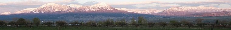

MineralMan
(146,317 posts)It's your best bet, overall. It skirts most of the mountains and will get you there in about the shortest time.

Faux pas
(14,681 posts)When I moved to Oregon from SoCal in 2000, I stopped at a truck stop in Medford for lunch. On my way out I asked the cashier 'When do you get out of the mountains?' First, everyone within ear shot got real quiet and then they all busted out
laughing. The cashier, who had to get control over her giggling answered 'You don't'.