The Hole of DeathBy: Peterr Saturday June 12, 2010 9:30 am
Back in the early 1970s, images like this view of earth taken by Apollo 17 gave humanity a new view of its home. I remember being struck by all kinds of things, like the lack of clear dividing lines between nations, the dance of clouds as weather patterns move around the globe, and the apparent fragility of our planet.

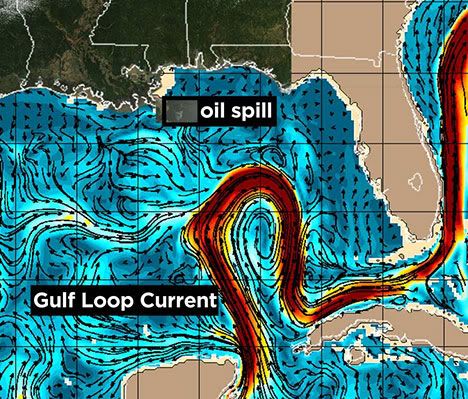
We are learning harsh lessons about that fragility, demonstrated all too well by the oil pouring into the Gulf of Mexico.
There is a hole in the middle of the Gulf. It is a hole of death, starting with the eleven oil rig workers, killed in the initial explosion.
Then came the oil, flowing out of that hole of death.
And the death began to spread.

The Southeast Regional Office of NOAAs National Marine Fisheries Service is the federal agency that oversees fishing in the Gulf both commercial and recreational. On May 7th, they closed around 10,807 square miles (27,989 square kilometers), or 4.5% of the US federal waters in the Gulf to all fishing, as illustrated by the red area in the map to the left. No fishing at all not for eating, and not for sport.
And the oil kept flowing, so the Fisheries Service kept revising their maps, noting on their FAQ
: Boundaries of the fishing closed area can be modified daily, based on dynamic oil spill conditions.

By May 11th, they had expanded the closure to cover an area of 16,027 square miles (41,511 square kilometers), or about 6.5% of the US federal fishing waters. Thats an area about the size of Massachusetts and Connecticut combined.
And the hole of death kept pumping its oil out into the waters of the Gulf, literally sucking the oxygen out of it, wherever it spread.
As Eli noted last night, This disaster was not some capricious whim of fate, it was actively courted by BPs impatience, greed and arrogance and MMSs complicit passivity.
It is truly a hole of death.

By May 21, the closure area had become 48,005 square miles (124,333 square kilometers) , which is just under 20% of the US federal fishing waters.
And all the while, the oil kept flowing.
The oil kept flowing under the water in plumes. The oil kept flowing on the water in greasy slicks. The oil kept flowing above the water in smoky clouds.
Out of the hole of death, the oil kept flowing

On May 25, the NMFS closed 60,683 square miles (157,169 square kilometers) of the Gulf waters to fishing , or about 25% of the waters under their jurisdiction.
Thats larger than the state of New York, larger than the state of Illinois, and larger than the state of Georgia.
Thats larger than the nation of North Korea, larger than Nicaragua, larger than Greece, and larger than Nepal.
And the oil kept flowing from the hole of death.

By June 7, the waters closed to fishing had expanded to 78,264 sq mi (202,703 sq km), or about 32% of the US federal fishing area.
And the oil still flows from the hole of death.
This oil kills.
It kills big marine life, like tuna and dolphins and turtles. It kills smaller marine life, like the shrimp and oysters. It kills the plankton and the vegetation that nourishes the lives of those higher on the Gulfs food chain.
The oil kills onshore as well. It kills marshes and beaches and shorelines the birds, the vegetation, and the unseen microscopic creatures that call the shores home. It is threatening to kill cities and towns who live in harmony with the Gulf fishing towns, tourist towns, all kinds of towns. It directly threatens businesses like oyster farmers and shrimpers, and indirectly major sectors of the entire Gulf coast economy.
And the oil still flows.
4% . . . 6.5% . . . 20% . . . 25% . . . 32% of the US waters in the Gulf, now closed to fishing.
I wonder what the Fisheries Service map will look like in August, when BPs relief wells will attempt to plug this hole of death from below. And while they drill, the oil still pumps relentlessly and furiously into the waters of the Gulf.
It is the hole of death.
<snip>
Link: http://firedoglake.com/2010/06/12/the-hole-of-death/
:evilfrown: