| Latest | Greatest | Lobby | Journals | Search | Options | Help | Login |
|
|
|
This topic is archived. |
| Home » Discuss » Topic Forums » Environment/Energy |
|
| phantom power
|
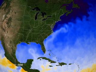
Sat Sep-01-07 03:42 PM Original message |
| Felix |
| Printer Friendly | Permalink | | Top |
| RL3AO
|
Sat Sep-01-07 03:58 PM Response to Original message |
| 1. Might get just as strong as Dean. In fact, I would say it has a 50% chance of reaching Cat 5. |
| Printer Friendly | Permalink | | Top |
| RL3AO
|
Sat Sep-01-07 06:53 PM Response to Original message |
| 2. Now a hurricane. |
| Printer Friendly | Permalink | | Top |
| GliderGuider
|
Sat Sep-01-07 07:06 PM Response to Reply #2 |
| 3. That was quick... |
| Printer Friendly | Permalink | | Top |
| RL3AO
|
Sat Sep-01-07 07:33 PM Response to Reply #3 |
| 4. TD to Cane in 27 hours. Very very quick. |
| Printer Friendly | Permalink | | Top |
| phantom power
|
Sun Sep-02-07 12:25 PM Response to Original message |
| 5. And now cat-2 |
| Printer Friendly | Permalink | | Top |
| GliderGuider
|
Sun Sep-02-07 01:15 PM Response to Reply #5 |
| 6. The 2:00 update has it at Cat 3. |
| Printer Friendly | Permalink | | Top |
| phantom power
|
Sun Sep-02-07 02:22 PM Response to Reply #6 |
| 7. Wow. Reminds me a bit of 2005. |
| Printer Friendly | Permalink | | Top |
| RL3AO
|
Sun Sep-02-07 02:26 PM Response to Reply #7 |
| 8. Actually we were on M by September. |
| Printer Friendly | Permalink | | Top |
| GliderGuider
|
Sun Sep-02-07 03:58 PM Response to Reply #6 |
| 9. 5:00 PM update - Cat 4. |
| Printer Friendly | Permalink | | Top |
| RL3AO
|
Sun Sep-02-07 04:02 PM Response to Reply #9 |
| 10. That is not warmer water, it is just deeper warm water. |
| Printer Friendly | Permalink | | Top |
| GliderGuider
|
Sun Sep-02-07 04:12 PM Response to Reply #10 |
| 11. So does that mean the mixing from the hurricane's passage |
| Printer Friendly | Permalink | | Top |
| RL3AO
|
Sun Sep-02-07 04:36 PM Response to Reply #11 |
| 12. Pretty much. |
| Printer Friendly | Permalink | | Top |
| GliderGuider
|
Sun Sep-02-07 05:10 PM Response to Reply #12 |
| 15. Thanks. I found an SST image from Friday |
| Printer Friendly | Permalink | | Top |
| phantom power
|
Sun Sep-02-07 04:47 PM Response to Reply #9 |
| 13. Uhhh. What the hell is this crap? |
| Printer Friendly | Permalink | | Top |
| phantom power
|
Sun Sep-02-07 05:04 PM Response to Original message |
| 14. Tropical Storm (70mph) to Cat-4 (140mph) in 24 hours. Rock on. |
| Printer Friendly | Permalink | | Top |
| GliderGuider
|
Sun Sep-02-07 07:18 PM Response to Original message |
| 16. And thar she blows |
| Printer Friendly | Permalink | | Top |
| GliderGuider
|
Sun Sep-02-07 07:41 PM Response to Original message |
| 17. Felix sets a speed record |
| Printer Friendly | Permalink | | Top |
| Dead_Parrot
|
Mon Sep-03-07 12:31 AM Response to Reply #17 |
| 18. Cool. Wonder what'll happen in the next 39? nt |
| Printer Friendly | Permalink | | Top |
| tom_paine
|
Mon Sep-03-07 11:18 AM Response to Reply #17 |
| 19. That's alotta energy in the atmosphere. Combine that with Arctic Summer Ice Data |
| Printer Friendly | Permalink | | Top |
| DU
AdBot (1000+ posts) |
Fri May 03rd 2024, 06:03 PM Response to Original message |
| Advertisements [?] |
| Top |
| Home » Discuss » Topic Forums » Environment/Energy |
|
Powered by DCForum+ Version 1.1 Copyright 1997-2002 DCScripts.com
Software has been extensively modified by the DU administrators
Important Notices: By participating on this discussion board, visitors agree to abide by the rules outlined on our Rules page. Messages posted on the Democratic Underground Discussion Forums are the opinions of the individuals who post them, and do not necessarily represent the opinions of Democratic Underground, LLC.
Home | Discussion Forums | Journals | Store | Donate
About DU | Contact Us | Privacy Policy
Got a message for Democratic Underground? Click here to send us a message.
© 2001 - 2011 Democratic Underground, LLC