Democratic Underground Latest Greatest Lobby Journals Search Options Help Login
Google

Tsunami sweeps docks away in Cresent City Ca.

Printer-friendly format Printer-friendly format
Printer-friendly format Email this thread to a friend
Printer-friendly format Bookmark this thread
This topic is archived.
Home » Discuss » Latest Breaking News Donate to DU
 
dixiegrrrrl Donating Member (1000+ posts) Send PM | Profile | Ignore Fri Mar-11-11 12:35 PM
Original message
Tsunami sweeps docks away in Cresent City Ca.
Edited on Fri Mar-11-11 12:48 PM by dixiegrrrrl
Source: live abc coverage Santa Barabara station

Reported a few minutes ago that Ca. Highway Patrol reports houses damaged, all docks were swept away by tsunami in Cresent City Ca.


Read more: http://abclocal.go.com/kgo/livenow?id=8007618


edited to add: I am still looking for other confirmation of this story.
Printer Friendly | Permalink |  | Top
liberal N proud Donating Member (1000+ posts) Send PM | Profile | Ignore Fri Mar-11-11 12:51 PM
Response to Original message
1. K&R
Printer Friendly | Permalink |  | Top
 
nadinbrzezinski Donating Member (1000+ posts) Send PM | Profile | Ignore Fri Mar-11-11 01:01 PM
Response to Original message
2. The twitter is going nuts on this
that is the first real damage we hear.

I am so glad to face southwards.
Printer Friendly | Permalink |  | Top
 
dixiegrrrrl Donating Member (1000+ posts) Send PM | Profile | Ignore Fri Mar-11-11 01:06 PM
Response to Reply #2
3. ah..I clean forgot to open my Twitter.
got any hashtags I should look for???
Printer Friendly | Permalink |  | Top
 
dixiegrrrrl Donating Member (1000+ posts) Send PM | Profile | Ignore Fri Mar-11-11 01:08 PM
Response to Original message
4. Never mind, I opened the Google Realtime link.
Tsunami waves expected to peak at 8.2 feet in Crescent City, CA within the next 2-4 hours

35 boats crushed under pier in Crescent City.
Printer Friendly | Permalink |  | Top
 
nadinbrzezinski Donating Member (1000+ posts) Send PM | Profile | Ignore Fri Mar-11-11 01:10 PM
Response to Reply #4
5. ok that is looking NORTH right?
The wave is coming from the NORTH.
Printer Friendly | Permalink |  | Top
 
Gormy Cuss Donating Member (1000+ posts) Send PM | Profile | Ignore Fri Mar-11-11 01:34 PM
Response to Original message
6. Crescent City is always a prime candidate for tsunami damage in CA.
It's been destroyed by tsunami in the past and there's a robust tsunami warning system in place. I stayed in a hotel on the beach and we were given a pamphlet on what to do in case of a tsunami warning. They don't play around. A large section of town is essentially at sea level and a wave could roar straight through it pretty quickly.
Printer Friendly | Permalink |  | Top
 
hatrack Donating Member (1000+ posts) Send PM | Profile | Ignore Fri Mar-11-11 01:58 PM
Response to Reply #6
7. They got pounded back in 1964 because of the Good Friday quake
10 or 12 people died, a good 1,500 miles from the epicenter.
Printer Friendly | Permalink |  | Top
 
uppityperson Donating Member (1000+ posts) Send PM | Profile | Ignore Fri Mar-11-11 02:04 PM
Response to Original message
8. NOAA report from Crescent City 8.1 ft.
Printer Friendly | Permalink |  | Top
 
necso Donating Member (1000+ posts) Send PM | Profile | Ignore Fri Mar-11-11 03:47 PM
Response to Original message
9. I took some government supplied data (thanks to the previous poster)
http://www.wrh.noaa.gov/total_forecast/getprod.php?wfo=sew&pil=TSU&sid=WCA&version=

and reorganized it a little bit. The data is a good representation of the pronounced differences in effect a tsunami can have (specifically, in areas not that far separated in terms of distance on the tsunami "line" of travel, and considering the distance of travel); and even if these numbers are not 100% accurate (and thus are later corrected), a substantial difference (multiplier effect) will likely remain.

CRESCENT CITY CA 8.1FT/02.47M (not in table but reported)
PORT SAN LUIS CA 6.3FT/01.93M
POINT REYES CA 4.4FT/01.35M
NORTH SPIT CA 3.1FT/00.95M
SANTA MONICA CA 2.4FT/00.74M
SANTA BARBARA CA 2.2FT/00.67M
LOS ANGELES CA 1.1FT/00.32M
LA JOLLA CA 1.0FT/00.31M
SAN DIEGO CA 0.7FT/00.21M

PORT ORFORD OR 6.1FT/01.85M

PORT ANGELES WA 1.9FT/00.59M

WINTER HARBOUR BC 1.7FT/00.53M

ADAK AK 3.4FT/01.05M
NIKOLSKI AK 2.7FT/00.82M
SAND POINT AK 1.6FT/00.49M
KING COVE AK 1.6FT/00.48M
SITKA AK 1.0FT/00.32M
CRAIG AK 0.8FT/00.24M
ELFIN COVE AK 0.5FT/00.16M
KODIAK AK 0.5FT/00.15M

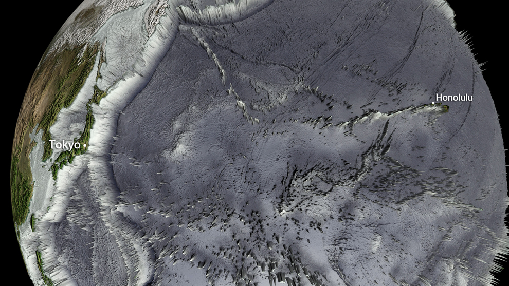
My guess is that some of this difference in effect is a result of offshore topography. (Onshore topography would dictate which areas "inland" are effected.) And such data is invaluable to local communities (and their counties, states) in planning, issuing alerts, posting warnings -- and in saving lives (of the receptive) and preventing property and personal damage.

(The question also arises whether there was some pronounced directionality of effect in the tsunami itself, ignoring the dampening or amplifying effects of topography.)
Printer Friendly | Permalink |  | Top
 
Peace Patriot Donating Member (1000+ posts) Send PM | Profile | Ignore Fri Mar-11-11 07:08 PM
Response to Reply #9
10. Thanks for your data organization! nt
Printer Friendly | Permalink |  | Top
 
necso Donating Member (1000+ posts) Send PM | Profile | Ignore Sat Mar-12-11 02:44 AM
Response to Reply #10
12. Post 11 and
Printer Friendly | Permalink |  | Top
 
somone Donating Member (1000+ posts) Send PM | Profile | Ignore Fri Mar-11-11 07:50 PM
Response to Original message
11. It was a clear shot across the ocean

This National Oceanic and Atmospheric Administration (NOAA) Global bathymetry map image released on March 11, 2011 shows features of the ocean floor depth (or bathymetry). The image shows the entire Western Pacific basin. Notice how abruptly the Japanese islands rise out of the ocean. Other coastal Asian areas have much more gradual slopes. The islands and mountain ranges throughout the ocean, visible in this imagery, also affect the tsunami travel time and speed. In the open ocean, tsunamis can travel at speeds up to 500 mph.


This National Oceanic and Atmospheric Administration (NOAA) image released on March 11, 2011 shows model runs from the Center for Tsunami Research at the NOAA Pacific Marine Environmental Laboratory showing the expected wave heights of the tsunami as it travels across the Pacific basin. The largest wave heights are expected near the earthquake epicenter off Japan. The wave will decrease in height as it travels across the deep Pacific but grow taller as it nears coastal areas. In general, as the energy of the wave decreases with distance, the near shore heights will also decrease.

http://www.boston.com/bigpicture/2011/03/massive_earthquake_hits_japan.html
Printer Friendly | Permalink |  | Top
 
DU AdBot (1000+ posts) Click to send private message to this author Click to view 
this author's profile Click to add 
this author to your buddy list Click to add 
this author to your Ignore list Sat May 04th 2024, 09:39 AM
Response to Original message
Advertisements [?]
 Top

Home » Discuss » Latest Breaking News Donate to DU

Powered by DCForum+ Version 1.1 Copyright 1997-2002 DCScripts.com
Software has been extensively modified by the DU administrators


Important Notices: By participating on this discussion board, visitors agree to abide by the rules outlined on our Rules page. Messages posted on the Democratic Underground Discussion Forums are the opinions of the individuals who post them, and do not necessarily represent the opinions of Democratic Underground, LLC.

Home  |  Discussion Forums  |  Journals |  Store  |  Donate

About DU  |  Contact Us  |  Privacy Policy

Got a message for Democratic Underground? Click here to send us a message.

© 2001 - 2011 Democratic Underground, LLC